Before they poured the foundation for the 84-unit Creekside subdivision in Raleigh, North Carolina, the drainage engineer ran the site through a computational fluid dynamics model that simulated 50 years of rainfall in an afternoon. Every roof, every driveway, every graded slope — modeled drop by drop through a one-inch-per-hour design storm. The model flagged three lots where runoff would overwhelm the planned bioswale within seven years as the clay subsoil compacted. They redesigned before a single trench was dug. A traditional engineering review would have caught the issue eventually. Probably after the first basement flooded.
Stormwater is the unglamorous crisis of American construction. The EPA identifies nonpoint source pollution — runoff carrying sediment, chemicals, and debris into waterways — as the leading remaining cause of water quality problems in the United States. Not factories. Not sewage plants. Rain hitting the ground you just paved.
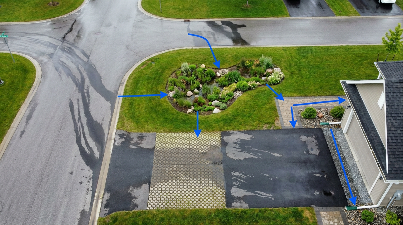
And it’s getting worse. A typical undeveloped acre absorbs roughly 80% of the rain that falls on it. Build a house, pour a driveway, and lay a patio, and that same acre now sheds 55–60% of rainfall as surface runoff. For a standard quarter-acre residential lot in a moderate-rainfall climate, that translates to approximately 27,000 gallons of runoff per year that wasn’t there before the bulldozer showed up.
Most jurisdictions now require new residential developments to manage 100% of the first inch of rainfall on-site. Some mandate post-development runoff volumes match pre-development conditions — essentially asking builders to make their impervious surfaces invisible to the watershed. It’s an engineering problem. And AI is turning it from a guessing game into a design discipline.
Real-Time Detention Is Here
OptiRTC (now Opti, a subsidiary of infrastructure giant Aliaxis) pioneered what they call Continuous Monitoring and Adaptive Control (CMAC) — IoT-connected stormwater facilities that adjust retention and release in real time based on weather forecasts and downstream conditions. Originally deployed on commercial and municipal sites, Opti’s technology achieved over 90% reduction in wet-weather releases and peak flows during NC State University trials from 2010 to 2013, while simultaneously reusing captured water for irrigation.
The residential angle is the interesting one. Opti’s system coordinates stormwater facilities across an entire development — the detention pond at the southeast corner talks to the bioswale network along the main road, which talks to individual lot rain gardens. Pre-storm, the system partially drains detention capacity based on the incoming forecast. During the storm, release valves throttle to prevent downstream flooding. After the storm, retained water routes to irrigation. Three patents. Three objectives from the same infrastructure.
“Every kilowatt-hour the building wastes is a design failure. Every gallon of runoff that leaves a developed lot without treatment is the same kind of failure — we just haven’t been measuring it as carefully.”
Parcel-Level Flood Modeling
First Street (formerly First Street Foundation) now models flood risk at 22.3 billion locations worldwide, with 22,000+ metrics per location. Their ClimateScore Global platform connects hazard intelligence to financial outcomes — not just “this area floods sometimes” but “this parcel has a 14% chance of 6 inches of standing water in the next 30 years, and that probability increases to 23% under a high-emissions scenario by 2050.”
For residential developers, that granularity matters. A 200-lot subdivision doesn’t have uniform flood risk across all 200 lots. AI-driven parcel-level modeling lets engineers design stormwater systems that allocate detention capacity where it’s actually needed — heavier infrastructure for the low-lying southwest quadrant, lighter bioswales for the elevated northeast lots. The result is less concrete, lower costs, and better performance than the one-size-fits-all approach that building codes still assume.
Jupiter Intelligence, trusted by Fannie Mae and major insurers, provides scenario-based climate risk modeling from present day to 2100. Their MRM-approved models are peer-reviewed and validated against decades of observed weather data. For a builder deciding whether to invest in permeable pavement for a new subdivision, Jupiter can quantify exactly how much flood risk increases over the 30-year mortgage horizon — and whether the green infrastructure investment pencils out against avoided insurance claims.
Green Infrastructure by Algorithm
Autocase brings triple-bottom-line economic analytics to stormwater decisions. Their software translates sustainable building design impacts into lifecycle cost metrics — helping developers compare rain gardens versus underground detention versus permeable pavement not just on construction cost, but on 30-year maintenance, carbon reduction, and stormwater credit value. Over $500 billion in completed assessments. More than 10,000 buildings analyzed.
The economics are counterintuitive. EPA data shows green infrastructure costs $3–$15 per square foot, while traditional pipe-and-pond systems run $5–$25 per square foot. Rain gardens, bioswales, and permeable pavement are often cheaper than concrete pipes — and they reduce urban heat islands, filter pollutants, and add property value in ways that culverts never will.
The problem has always been engineering confidence. How do you size a bioswale for a 100-year storm when climate change is shifting rainfall intensity curves? How do you guarantee permit compliance when the soil infiltration rate on lot 47 is half what it is on lot 12? AI-driven modeling tools are closing that confidence gap. They simulate thousands of storm scenarios against site-specific soil data, grading plans, and projected impervious surface coverage — then optimize green infrastructure placement and sizing to meet detention requirements at minimum cost.
The Construction Site Problem
There’s another angle that doesn’t get enough attention: construction-phase stormwater. The EPA requires a Clean Water Act NPDES permit for any construction activity disturbing one acre or more. The federal C&D rule mandates erosion and sediment controls, immediate stabilization of disturbed areas within 14 days of work cessation, and prohibits discharge of concrete washout, fuels, and chemical runoff.
Enforcement is spotty. Compliance is expensive. And the traditional approach — silt fences, check dams, sediment ponds — is designed and inspected manually. AI-powered site monitoring using drone imagery and computer vision is emerging to automate erosion tracking, flag areas where sediment controls have failed, and generate compliance documentation that survives an EPA audit. It’s the same technology that Buildots uses for build-versus-BIM tracking, repurposed for environmental compliance.
What Builders Actually Need
The honest assessment: most of these tools were built for municipal engineers managing $50 million infrastructure portfolios, not custom builders grading a two-acre lot. OptiRTC’s real-time control makes economic sense at the subdivision scale, not the single-home scale. First Street’s parcel-level data is embedded in institutional platforms (Fannie Mae, major insurers) but isn’t yet standard in residential site design software.
The gap is closing. EPA’s Green Infrastructure Strategic Agenda 2035, published September 2025, explicitly prioritizes scaling green infrastructure through community planning, regulatory integration, and federal funding. The 2019 Clean Water Act amendment formally defined green infrastructure in federal law for the first time. And the $115 billion in stormwater investment needs identified by EPA’s 2022 Clean Watersheds Needs Survey will increasingly flow toward AI-optimized solutions — because traditional engineering alone can’t keep up with changing rainfall patterns and expanding impervious surface coverage.
For any builder starting a subdivision in 2026, the question isn’t whether to manage stormwater intelligently. Permits already require it. The question is whether you design with an algorithm that tests 10,000 storm scenarios against your actual site data, or with the engineering rules of thumb that assume the climate of 1990 still applies. One of those approaches handles the next 50 years of rainfall. The other handles the last 50.
Sources: EPA — Nonpoint Source Pollution Overview · EPA — 2022 Clean Watersheds Needs Survey ($115B stormwater investment need) · EPA — About Green Infrastructure (cost comparisons, 2019 CWA amendment) · EPA — Construction Stormwater NPDES Permits · OptiRTC (Opti) — CMAC technology, NC State trials, 90%+ wet-weather reduction · First Street — ClimateScore Global (22.3B locations, 22K+ metrics) · Jupiter Intelligence — ClimateScore Global, MRM-approved climate risk models · Autocase — Triple-bottom-line stormwater analytics ($500B+ assessments) · EPA Green Infrastructure Strategic Agenda 2035 (Sept 2025)